Short
Private boat
Meeting only, short and quiet
- Length1.5 hours
- GuideEnglish and more
- Fromfrom $204
Guides
Language
Currency
See what is openfrom $55 · cancelling is freeFind a stop on the map
See all 48 stops
Choose a route, then tap a marker or stop for a note and Google Maps.
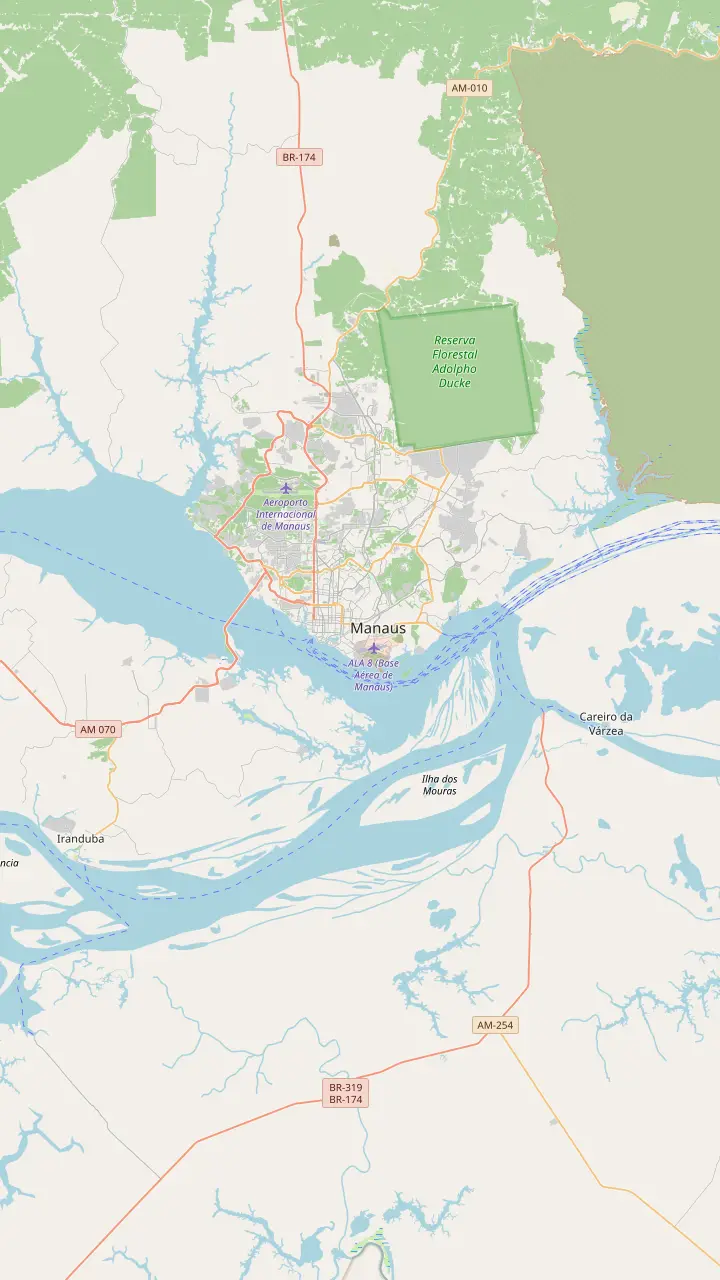
Where the Negro and the Solimões run side by side within one channel for several kilometers.
Google MapsThe site of the Encontro das Águas park, designed by Oscar Niemeyer, in the Colônia Antônio Aleixo district; works were under way.
Google MapsThe Rio Negro Bridge crosses the Negro at Manaus, not the Amazon itself.
Google MapsThe river port of Manaus; the Negro level is read here, and gauge records are kept at the port.
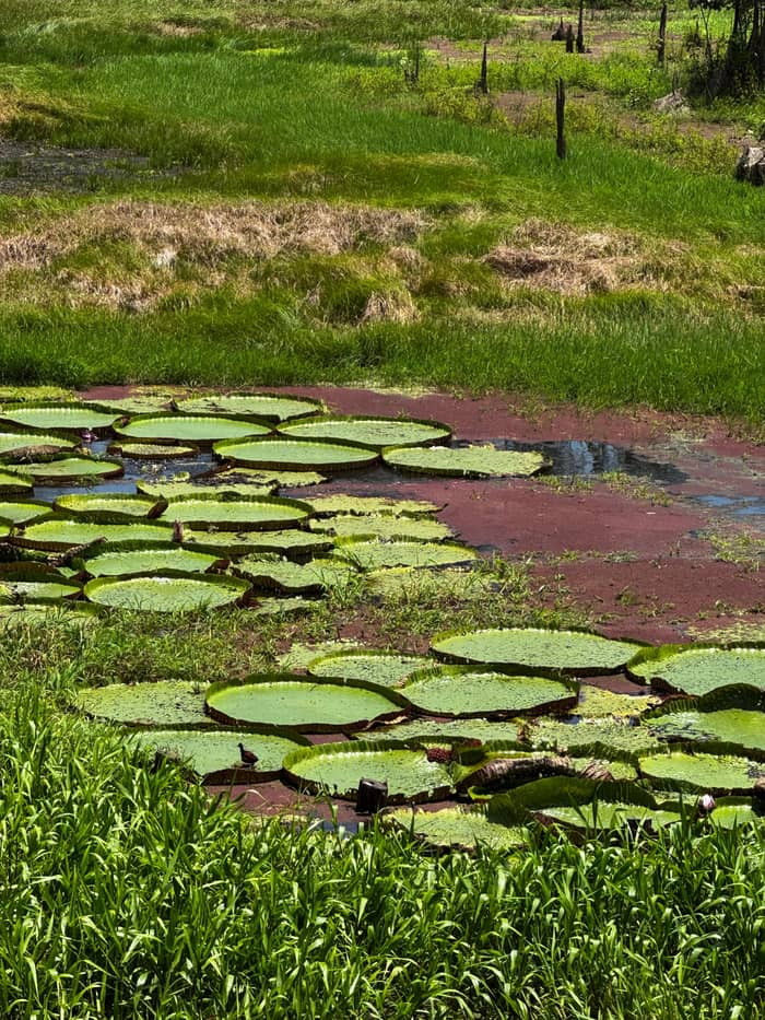
Google MapsThe Janauari area, on the lake that the site tour reaches by boat for the Meeting of the Waters and the water lilies.
Google MapsThe city beach on the Rio Negro, busiest on weekends.
Google MapsA riverside viewpoint on Avenida Sete de Setembro in the center.
Google Maps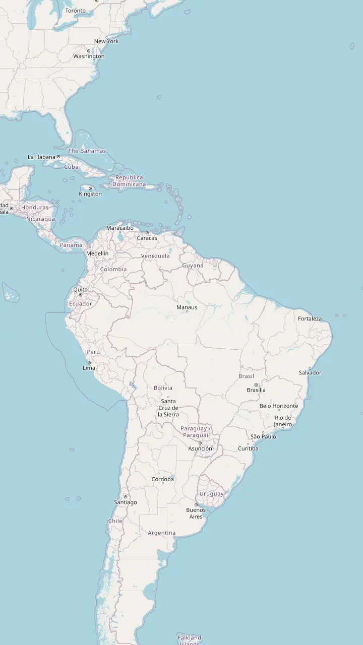
The capital and largest city of Amazonas, where the Solimões and the Negro form the Amazon.
Google MapsPeru's departure point for river journeys into the rainforest.
Google MapsA river town on the upper Solimões, read as a gauge station by the Geological Survey of Brazil.
Google MapsA river port downstream of Manaus; a ferry of 36 hours links the two cities.
Google MapsThe Amazon reaches the Atlantic in Brazil; a local boat trip of 5 days runs from Manaus to Belem.
Google MapsA gauge town on the Madeira river, in Rondônia.
Google Maps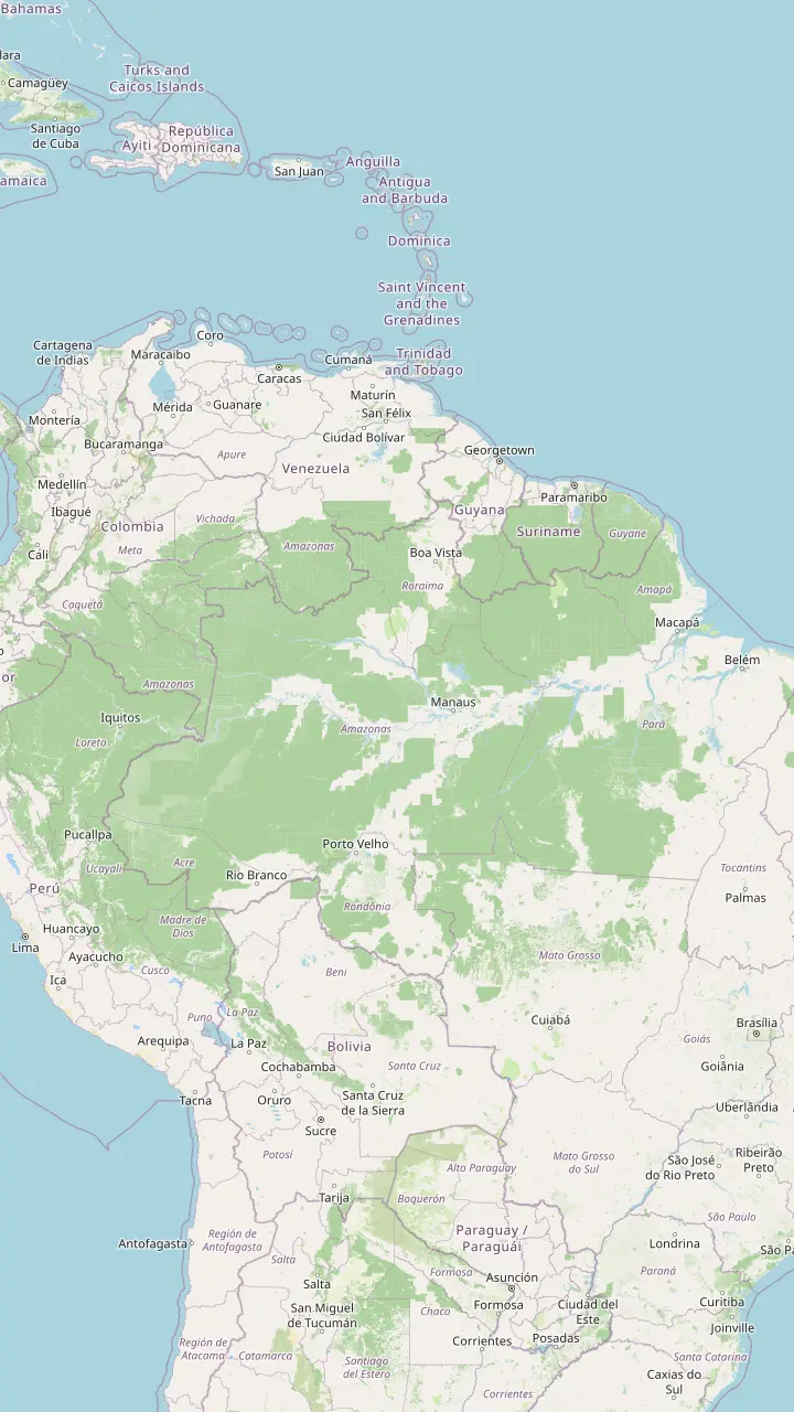
A river town on the upper Solimões, read as a gauge station by the Geological Survey of Brazil.
Google MapsA Solimões gauge town west of Manaus.
Google MapsThe capital and largest city of Amazonas, where the Solimões and the Negro form the Amazon.
Google MapsA gauge station on the Amazon itself, below the meeting.
Google MapsA second gauge station on the Amazon, farther downstream.
Google MapsA gauge station on the Purus, a tributary that joins the Solimões.
Google MapsA gauge town on the Madeira river, in Rondônia.
Google MapsA gauge station on the Madeira in Amazonas.
Google MapsThe Rio Branco gauge town in Roraima; the Branco is the Negro's largest tributary.
Google MapsA second Rio Branco gauge town in Roraima.
Google MapsA river port downstream of Manaus; a ferry of 36 hours links the two cities.
Google Maps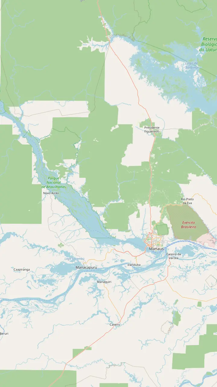
The capital and largest city of Amazonas, where the Solimões and the Negro form the Amazon.
Google MapsWhere the Negro and the Solimões run side by side within one channel for several kilometers.
Google MapsThe Janauari area, on the lake that the site tour reaches by boat for the Meeting of the Waters and the water lilies.
Google MapsA sustainable development reserve just 25 minutes by river from Manaus.
Google MapsA river archipelago of more than 400 islands in the Rio Negro.
Google MapsThe town on the Anavilhanas side of the Negro, upriver from Manaus.
Google MapsA waterfall day trip of 12 hours from Manaus.
Google Maps
Opened on 31 December 1896; the dome carries 36,000 ceramic scales in the colors of the flag.
Google MapsThe church on Largo São Sebastião, beside the opera house, with the famous wave-pattern paving square around it.
Google MapsOpened in 1883 on the bank of the Rio Negro, with a free entrance.
Google MapsThe city museum opened in 2018 and has eight rooms; entry is free by appointment.
Google MapsA provincial residence from 1875 that now holds five museums.
Google MapsThe Rio Negro palace is an optional stop on the private city tour in the listing.
Google MapsThe river port of Manaus; the Negro level is read here, and gauge records are kept at the port.
Google Maps
The Museu da Amazônia, with a 42-meter tower over the Adolpho Ducke forest reserve.
Google MapsINPA's science woods, opened in 1995, with a manatee tank and a giant otter enclosure.
Google MapsThe CIGS zoo in west Manaus, with a collection of regional animals.
Google MapsThe city's largest stadium, opened in 2014 and shaped like a large straw basket.
Google MapsThe city beach on the Rio Negro, busiest on weekends.
Google MapsA sustainable development reserve just 25 minutes by river from Manaus.
Google Maps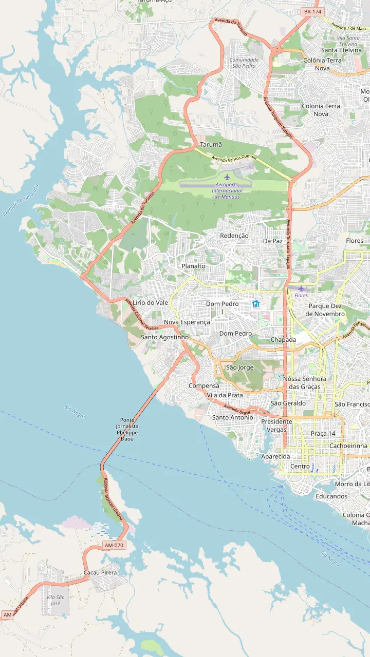
Manaus airport lies north of the center, in the Tarumã district.
Google MapsOpened on 31 December 1896; the dome carries 36,000 ceramic scales in the colors of the flag.
Google MapsThe river port of Manaus; the Negro level is read here, and gauge records are kept at the port.
Google MapsThe city beach on the Rio Negro, busiest on weekends.
Google MapsMap data: © OpenStreetMap contributors
At Manaus a black river and a brown river share a channel for kilometers without mixing. Here is why, which rivers feed the basin, how the water level swings and how a boat day shows it all.
Editorial team, amazonrivertour.quest · Updated November 12, 2026 · 8 mins to read
Overview
The Meeting of the Waters, in Portuguese the Encontro das Águas, is the place where the rivers of the Amazon stop being theory and become a view from a boat. NASA describes the spot east of Manaus, where the rivers join and keep to separate lanes of one channel for several kilometers.1 The line between them is sharp enough to be visible from space and from the surface of the water.2
The boundary does not hold forever. Swirling eddies, driven by the quicker whitewater, finally blend the pair into the Lower Amazon River, NASA says.7 In plain terms the seam is a long, slow handshake, not a wall, and it is visible for as long as the rivers keep their separate speeds. Downstream the mixing zone runs on through the rainforest for hundreds of kilometers, and NASA counts it a famous draw for tourists worldwide.8
What makes the sight special to a visitor is how ordinary it looks from the deck. There is no waterfall and no cliff, just a seam on a very wide river, with coffee-colored water on one side and dark tea on the other. Look for the seam first, then follow it with your eyes toward the horizon, and you will see how long the colors keep their separate lanes before the river blends them into a single brown flow.
Ask why the Amazon River is so brown and the answer starts in the Andes. Sediment-heavy, coffee-colored water pours off the Andes along the Rio Solimões, and NASA says the huge load of mud worn from those mountains is what tans the Solimões.9,3 The Solimões is what Brazilians call the upper Amazon, so the brown river you see downstream of Manaus is the same river wearing a new name.5
The Negro is dark for the opposite reason. Its water is almost free of sediment and tinted by rotted leaves and plants, NASA says, because the low jungles it drains erode little rock and so send little mud into the river.10 Instead of mud, matter from the forest floor dyes the river like strong black tea.4 NASA adds that blackwater rivers drain only lowland forest soils, full of leaves and other rotting material.11
Color is a clue to a river's chemistry, not to its cleanliness. Neither a black river nor a brown one tells you whether the water is safe to drink, which is why travelers are advised to carry sealed bottled water on any river day, whatever the color of the river outside the window. The colors do tell a naturalist a great deal, which is why guides lean over the rail to explain them at the seam, and why a good commentary adds to the sight.
Scientists sort the Amazon's rivers into three types by color: blackwater, clearwater and whitewater, which differ significantly in their physical and chemical properties.18 The Negro is the classic blackwater river, the Solimões the main whitewater river, and the Tapajós a clearwater river that the same study describes as having crystalline, slightly greenish water with little clayey sediment.20,21
The numbers show the contrast. In a study of the three rivers the Negro had a pH of 4.6, which is acidic, while the Tapajós measured around 6.0 and the Solimões around 6.3, both close to neutral.16 Conductivity, a sign of dissolved ions, was 10.5 microsiemens in the Negro, 17.3 in the Tapajós and 74.2 in the Solimões.17 That is why the Negro is described as poor in ions and the Solimões as rich in them.
The difference spills over into life. The Solimões supplies nutrient-rich mud to floodplain lakes, so muddy lakes differ in their ecology from nutrient-poor blackwater rivers and lakes.22 For travelers this means that a day on a muddy river looks and sounds different from a day on a black one: more floodplain meadows and fish in the first, quieter flooded forest in the second, as the Anavilhanas archipelago in the Negro shows.23
Which trip
Match your time and budget to the way you want to reach the meeting.
If I have only a couple of hours
The private boat
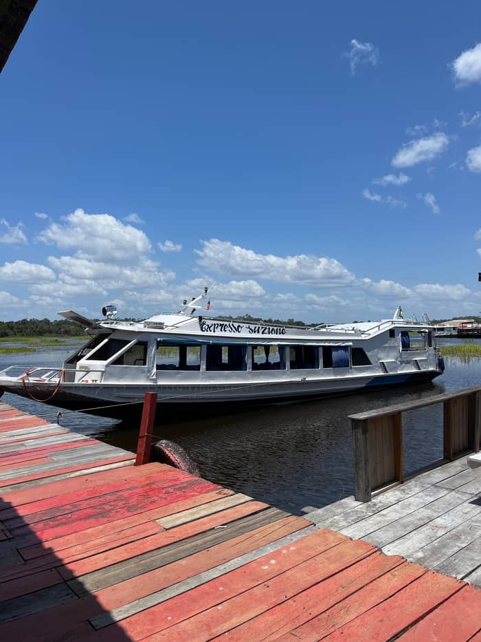
A private boat tour of 1.5 hours.
If I want lunch and a village too
The speedboat day
7 hours with lunch at the Janauari park.
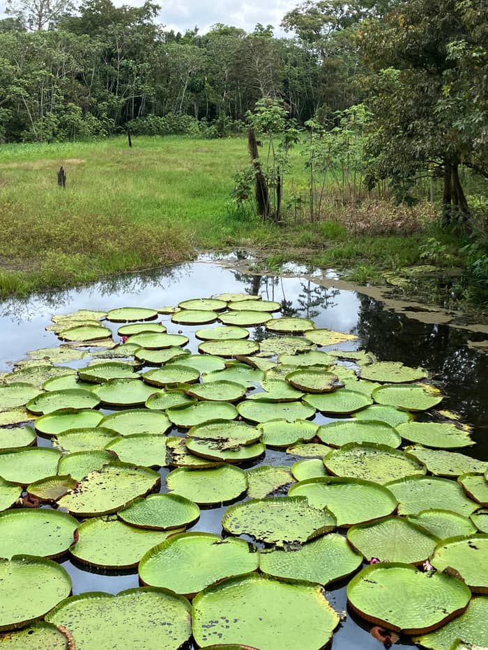
If I want canoes and water lilies
The full-day tour
It includes canoes into the water-lily channels.
If I would like the lowest price
The full-day tour
Listed from $55.
If I want a quiet group of my own
The private boat
A private boat tour of 1.5 hours.
If I am traveling in high water
Ask about the canoe stops
Channels are wider from May to July.19
Ways to see it
Short
Meeting only, short and quiet
Medium
Meeting, village, lunch
Fullest
Lake, canoes, village
The short answer is the Amazon itself, but the long answer is a family of rivers, each with its own color and character. In NASA's account the Amazon begins at Manaus, where the Solimões (the upper Amazon River) and the Negro come together.5 Beyond them, the Rio Branco is the largest tributary of the Rio Negro, and the Geological Survey of Brazil reads the Branco at Boa Vista and Caracaraí in Roraima.38,37
On the southern side of the basin the same survey reads the Madeira at Porto Velho and Humaitá, the Purus at Beruri, and the Amazon itself at Careiro and Itacoatiara below Manaus.28,36,35 The Tapajós is a clearwater river, and the Solimões is read at Tabatinga and Manacapuru upriver of the meeting.21,26 The basin map above plots those gauge towns, so you can see how the system hangs together.
A river system this size has no single bank. By the treaty organization's reckoning, the journey from the Peruvian source to the Atlantic coast of Brazil exceeds 6,992 km and crosses eight countries.27 At Manaus you stand roughly in the middle of that journey, looking at the point where the biggest tributaries have already arrived and the river has taken its famous name, a good place to take stock of everything upstream.
Price the meeting
Compare the boat days and see what your group would pay.
Look at 3 options
Compare the boat days and see what your group would pay.
≈
View≈
View≈
ViewStarting prices as on the booking platform, converted at the ECB reference rate. You see the exact price at booking.
A speedboat day
Pickup
A drive of 30 minutes from the hotel.
Viewpoint
A viewpoint stop on the way.
The meeting
The Meeting of Waters by speedboat.
Village
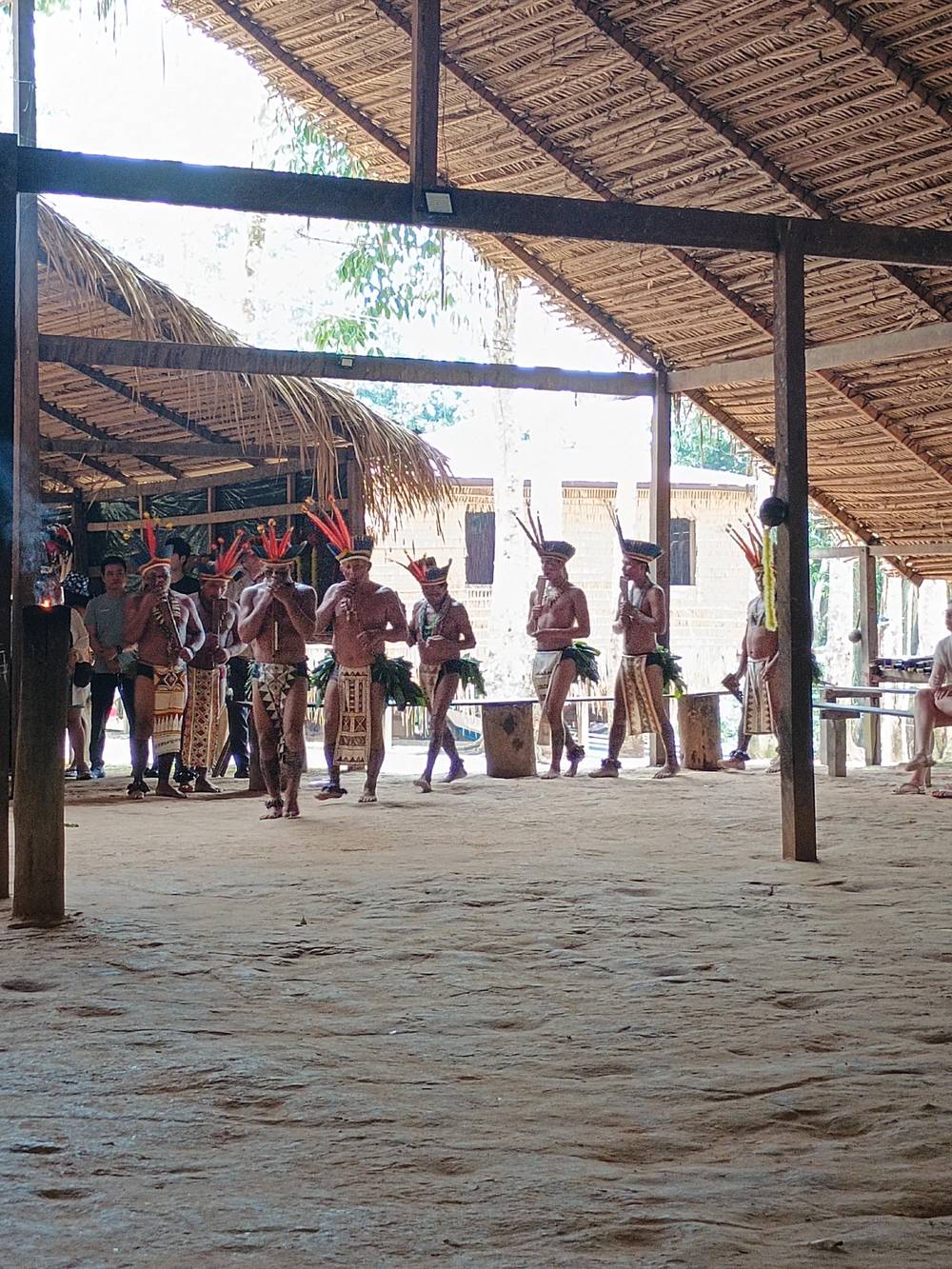
A stop at a traditional village.
Lunch
Lunch at the Janauari Ecological Park.
The end
The day of 7 hours closes with a walk.
The scale is hard to picture on a page, so NASA quotes a river scientist. Robert Meade, who spent decades studying rivers for the US Geological Survey, compared the meeting to 6 Mississippis of coffee-colored water joining 2 Mississippis of black-tea-colored water.57 He added that the volume is at least 12 times greater than the water falling over Niagara, Iguassu and Victoria Falls combined.58
The rivers also differ in depth and width. The Solimões runs far shallower than the Negro, NASA explains, since heavy sediment has packed its valley and riverbed.59 In one part of NASA's image of the confluence, the Negro River is almost 20 km wide.60 Anyone who has crossed the Negro by boat will know that the other bank can be a thin green line, and that a day on the water is a day on something closer to a sea than a stream.
That volume is the reason this is a place where the boat itself matters. A canoe on a side channel and a speedboat on the main river are very different experiences. The canoe, in the narrow braided channels west of the confluence, carries muddy Solimões water into the Negro during most seasons, and NASA notes that boats sometimes use these lowland channels to avoid going all the way to the main confluence.61,56
Video
Travel: The Good, The Bad & The Funny on YouTube · Until you tap play, no video is loaded.
The cooler, denser, and faster waters of the Solimões and the warmer, slower waters of the Negro form a boundary visible from space and from the water surface itself
On the boat
The Negro rises and falls through the year, and the meeting changes with it, week by week, so no two visits look quite alike. NASA says channels are much wider in the high-water season of May to July, when levels rise several meters, and the rivers are near their low-water stage in September.19 A tour listing from Manaus describes a longer cycle: the water begins its climb in November and peaks in June.
The extremes can be dramatic. At the port of Manaus the Negro reached a record high of 29.77 meters, flooding the city, and a record low of 13.63 meters in December 2010, just 16 months later.15,12 The swing between those two readings is the main reason local operators talk about water level before they talk about anything else. On 3 October 2023 the level had dropped to 15.14 meters, compared with 19.59 meters on 8 October 2022, which NASA calls a more typical level for October.13,14
For a visitor, high water means a wider, more flooded landscape and canoes through flooded forest, while low water means exposed banks, longer walks from the landing and some channels closed, so the same tour can feel like a different trip from one month to the next. The Meeting of the Waters is there in both seasons; what changes is the supporting cast. Ask your operator which stops the current water level allows before you choose a date.
The Manaus city government says the meeting, where the dark waters of the Rio Negro meet the muddy waters of the Rio Solimões, can be seen on a boat trip, which is the plain reason every tour of the area starts at the river.6 Listings from Manaus offer several versions. A private boat tour of 1.5 hours starts with a drive of 35 minutes, then a guided ride on the Rio Negro and time at the meeting, from $204.
A speedboat day of 7 hours adds the Mirante Lucia Almeida viewpoint, a traditional village, a visitor center and lunch at the Janauari Ecological Park, from $63, which gives the visit more of a full-day shape than a quick photo stop. The site's own full-day tour gets to the seam by boat via Lake Janauari, moves to canoes in the water-lily channels, calls at a village and serves a fish lunch, from $55.
The city is also building a viewing place of its own. The Manaus city hall is working on the Parque Encontro das Águas Rosa Almeida, conceived by Oscar Niemeyer, in the Colônia Antônio Aleixo district in the east zone of the city.32,33 Until that opens, the boat is the way to see the seam. Bring a hat and a dry bag, and give the boat time to run the full line; it is a long, slow reveal, not a quick stop.
FAQ
NASA says sediment eroded from the Andes gives the Solimões its tan color.3
Matter from the forest floor dyes it like black tea.4
NASA says cooler, denser, faster Solimões and warmer, slower Negro form a visible boundary.2
NASA says they keep to separate lanes of one channel for several kilometers.1
The Amazon forms at Manaus from the Solimões and the Negro.5
NASA places it east of Manaus, Brazil.1
The city government says a boat trip lets you see the meeting.6
NASA says channels are wider in the May to July high-water season.19
Sources
Heading for the Amazon? Ask a real person here.