Easiest
River and lakes
Boat, canoes, village
- Length1 day
- PickupHotel or airport
- GuideIn English
Guides
Language
Currency
See what is openfrom $55 · cancelling is freeFind a stop on the map
See all 48 stops
Choose a route, then tap a marker or stop for a note and Google Maps.
The capital and largest city of Amazonas, where the Solimões and the Negro form the Amazon.
Google MapsPeru's departure point for river journeys into the rainforest.
Google MapsA river town on the upper Solimões, read as a gauge station by the Geological Survey of Brazil.
Google MapsA river port downstream of Manaus; a ferry of 36 hours links the two cities.
Google MapsThe Amazon reaches the Atlantic in Brazil; a local boat trip of 5 days runs from Manaus to Belem.
Google MapsA gauge town on the Madeira river, in Rondônia.
Google Maps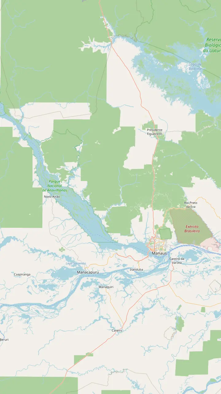
The capital and largest city of Amazonas, where the Solimões and the Negro form the Amazon.
Google MapsWhere the Negro and the Solimões run side by side within one channel for several kilometers.
Google MapsThe Janauari area, on the lake that the site tour reaches by boat for the Meeting of the Waters and the water lilies.
Google MapsA sustainable development reserve just 25 minutes by river from Manaus.
Google MapsA river archipelago of more than 400 islands in the Rio Negro.
Google MapsThe town on the Anavilhanas side of the Negro, upriver from Manaus.
Google MapsA waterfall day trip of 12 hours from Manaus.
Google Maps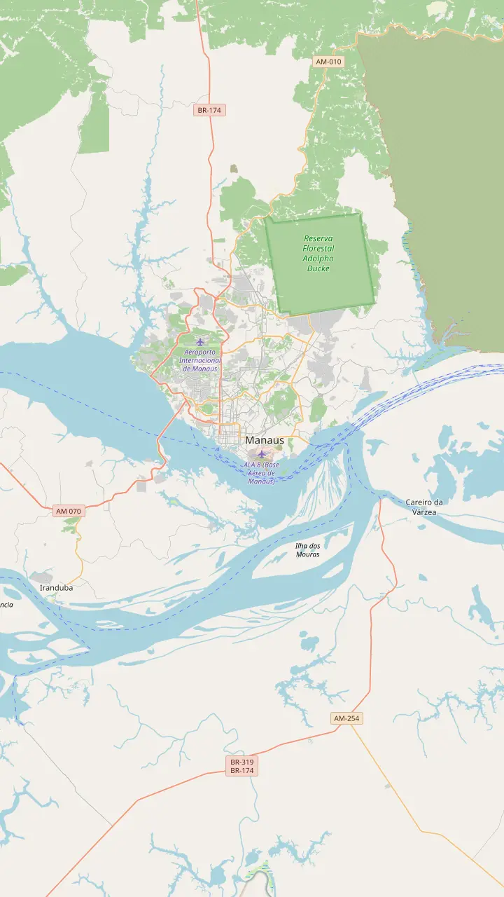
Where the Negro and the Solimões run side by side within one channel for several kilometers.
Google MapsThe site of the Encontro das Águas park, designed by Oscar Niemeyer, in the Colônia Antônio Aleixo district; works were under way.
Google MapsThe Rio Negro Bridge crosses the Negro at Manaus, not the Amazon itself.
Google MapsThe river port of Manaus; the Negro level is read here, and gauge records are kept at the port.
Google MapsThe Janauari area, on the lake that the site tour reaches by boat for the Meeting of the Waters and the water lilies.
Google MapsThe city beach on the Rio Negro, busiest on weekends.
Google MapsA riverside viewpoint on Avenida Sete de Setembro in the center.
Google Maps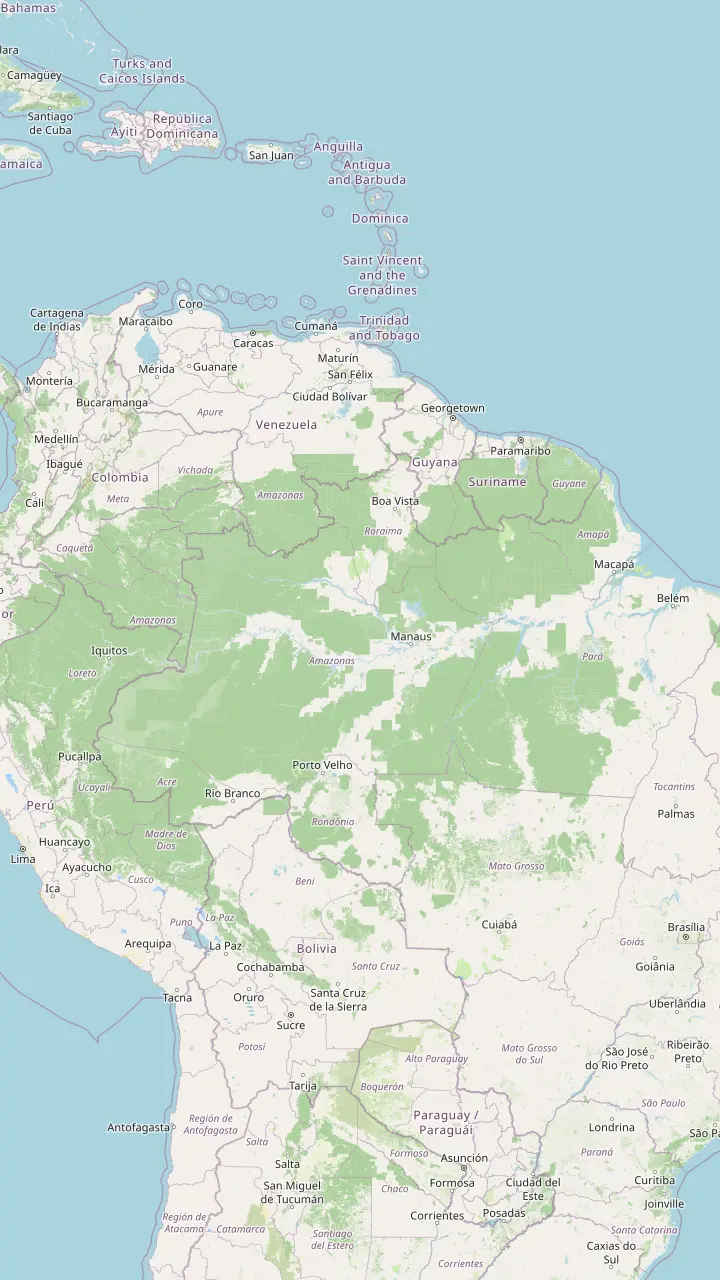
A river town on the upper Solimões, read as a gauge station by the Geological Survey of Brazil.
Google MapsA Solimões gauge town west of Manaus.
Google MapsThe capital and largest city of Amazonas, where the Solimões and the Negro form the Amazon.
Google MapsA gauge station on the Amazon itself, below the meeting.
Google MapsA second gauge station on the Amazon, farther downstream.
Google MapsA gauge station on the Purus, a tributary that joins the Solimões.
Google MapsA gauge town on the Madeira river, in Rondônia.
Google MapsA gauge station on the Madeira in Amazonas.
Google MapsThe Rio Branco gauge town in Roraima; the Branco is the Negro's largest tributary.
Google MapsA second Rio Branco gauge town in Roraima.
Google MapsA river port downstream of Manaus; a ferry of 36 hours links the two cities.
Google Maps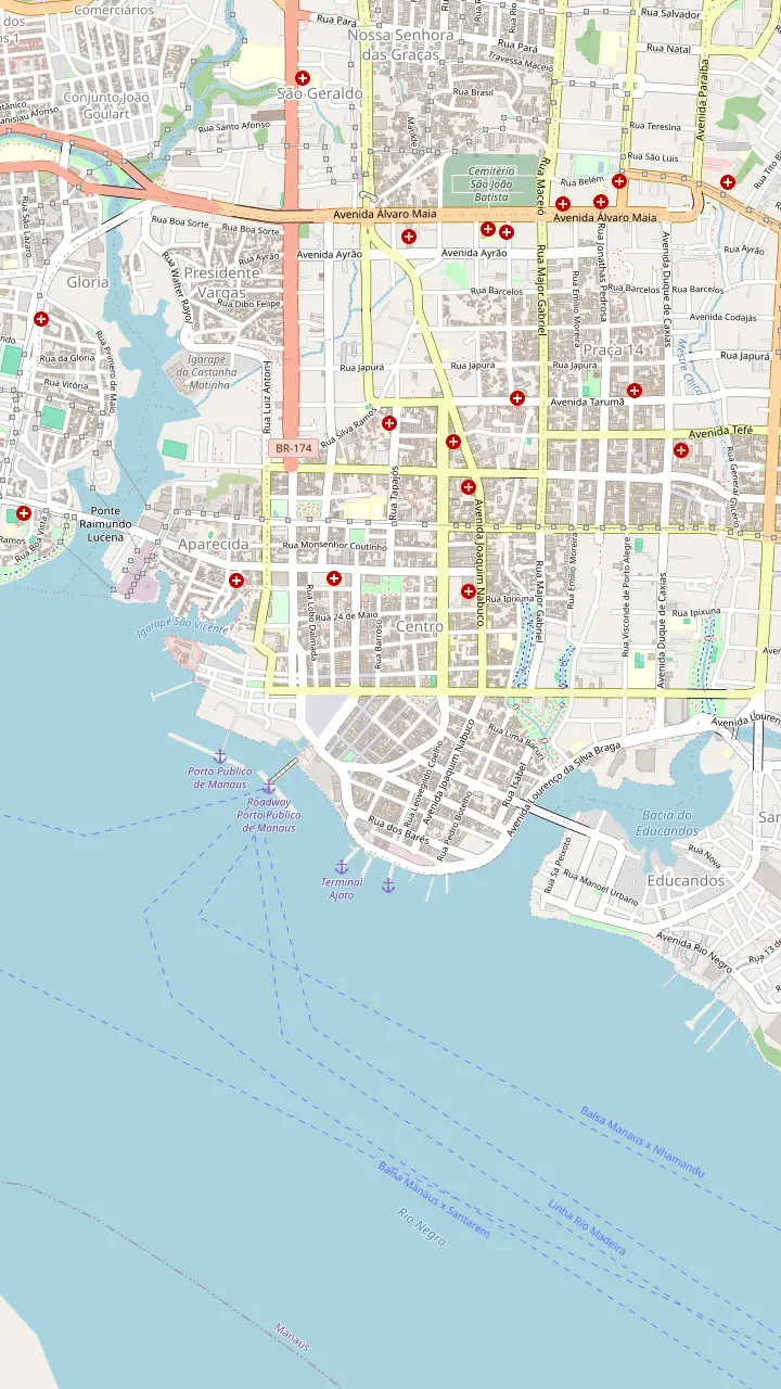
Opened on 31 December 1896; the dome carries 36,000 ceramic scales in the colors of the flag.
Google MapsThe church on Largo São Sebastião, beside the opera house, with the famous wave-pattern paving square around it.
Google MapsOpened in 1883 on the bank of the Rio Negro, with a free entrance.
Google MapsThe city museum opened in 2018 and has eight rooms; entry is free by appointment.
Google MapsA provincial residence from 1875 that now holds five museums.
Google MapsThe Rio Negro palace is an optional stop on the private city tour in the listing.
Google MapsThe river port of Manaus; the Negro level is read here, and gauge records are kept at the port.
Google Maps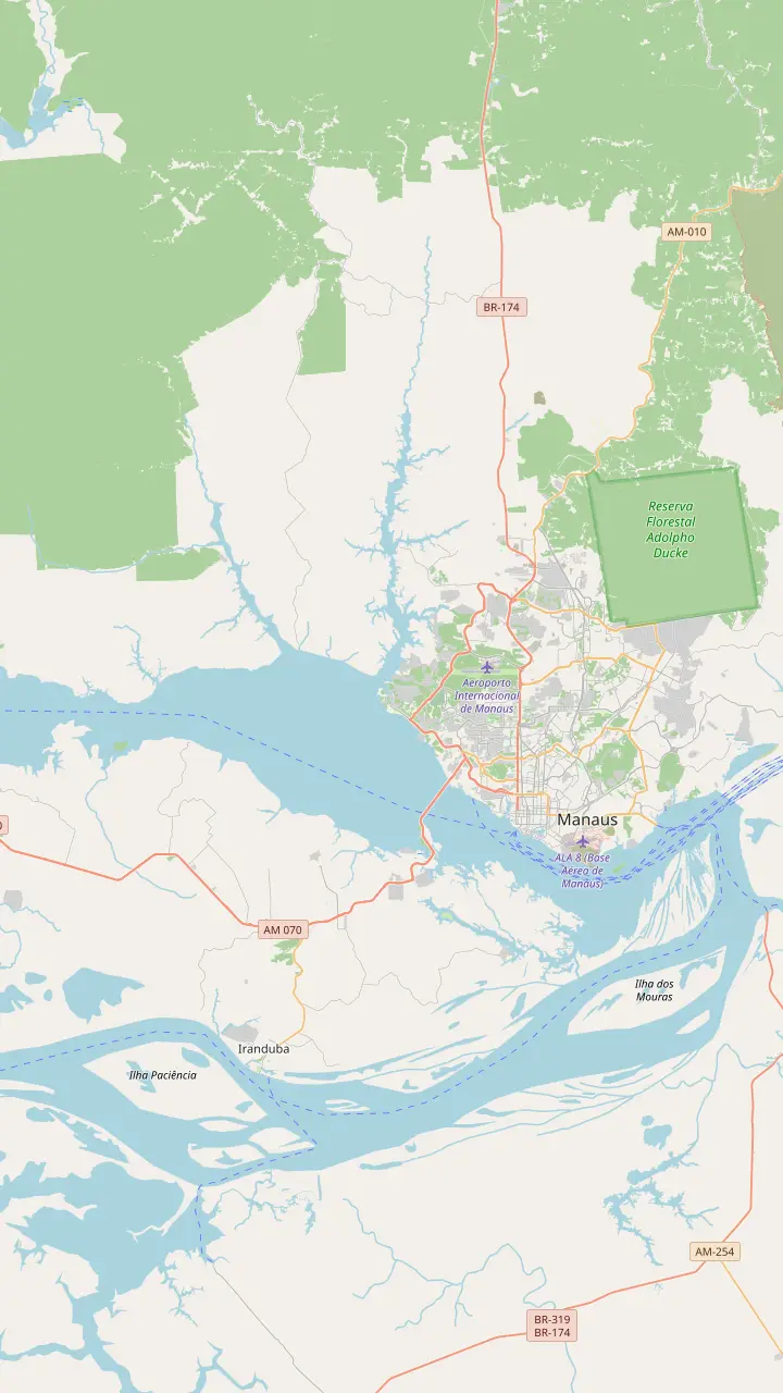
The Museu da Amazônia, with a 42-meter tower over the Adolpho Ducke forest reserve.
Google MapsINPA's science woods, opened in 1995, with a manatee tank and a giant otter enclosure.
Google MapsThe CIGS zoo in west Manaus, with a collection of regional animals.
Google MapsThe city's largest stadium, opened in 2014 and shaped like a large straw basket.
Google MapsThe city beach on the Rio Negro, busiest on weekends.
Google MapsA sustainable development reserve just 25 minutes by river from Manaus.
Google Maps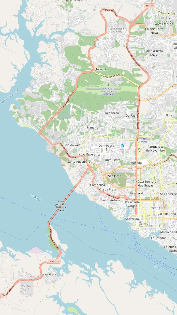
Manaus airport lies north of the center, in the Tarumã district.
Google MapsOpened on 31 December 1896; the dome carries 36,000 ceramic scales in the colors of the flag.
Google MapsThe river port of Manaus; the Negro level is read here, and gauge records are kept at the port.
Google MapsThe city beach on the Rio Negro, busiest on weekends.
Google MapsMap data: © OpenStreetMap contributors
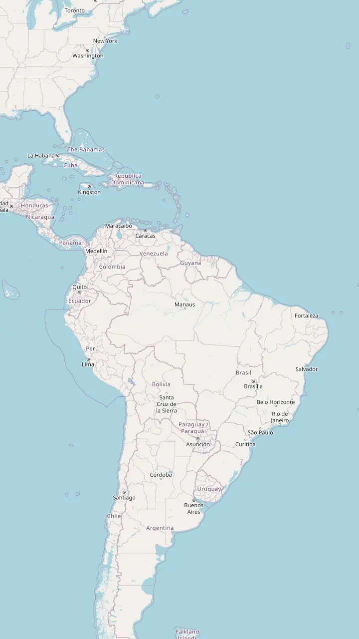
The rainforest covers a huge part of northern South America, and Manaus sits near its center. Here is where it lies, which country holds most of it, and the cities that open the way in.
Editorial team, amazonrivertour.quest · Updated November 12, 2026 · 9 mins to read
Overview
The Amazon rainforest lies in the north of South America, around the great river that gives it its name. The Government of Brazil ranks the Amazon as the planet's biggest biome, about 4.2 million km2 in all, shared by nine countries.1 They are Brazil, Peru, Colombia, Bolivia, Venezuela, Ecuador, Guyana, Suriname and French Guiana. Most visitors meet it in Brazil or Peru, but the forest does not care about borders.
The drainage basin is bigger still. The Amazon Cooperation Treaty Organization says the basin spans more than 6.1 million km2, covering 44% of South America's land area, and holds more than half of the tropical forest.6,7 FAO calls the region's forest the largest continuous tropical forest in the world.8 Those are different ways of measuring, so the figures should not be added together.
For a reader planning a trip, the useful picture is simple. Draw a line from the Andes in the west to the Atlantic coast of Brazil in the east, and the river and its rainforest fill the space in between. Manaus sits near the middle of that line, at the point where big rivers become the Amazon, which makes it a convenient city from which to see the real forest rather than a photograph of it.
Gateways compared
| City | Country | What it offers |
|---|---|---|
| Manaus | Brazil | Hub of the upper Amazon, tours by boat in a day |
| Iquitos | Peru | Departure point for river journeys |
| Tabatinga | Brazil | River town on the upper Solimões |
| Santarém | Brazil | Ferry port 36 hours from Manaus |
| Belém | Brazil | Boat trip of 5 days from Manaus |
| Porto Velho | Brazil | A gauge town on the Madeira |
As NASA, Peru's tourism board, the Geological Survey of Brazil and the listings describe them.3,5,10,15
Brazil. FAO describes the immense Amazonian plain as lying mostly inside Brazil.12 In Brazil's own accounting, the Amazon region makes up 61 percent of the country's land area, or 5.3 million square kilometers.2 That figure uses a political boundary, so it will not match the 4.2 million km2 the same government gives for the biome, but both point to the same conclusion: most of the forest is Brazilian.1
The remaining countries share what is left, each with its own gateway towns and its own rules for visitors. The Amazon Cooperation Treaty Organization counts eight member countries, namely Brazil, Peru, Colombia, Venezuela, Bolivia, Ecuador, Guyana and Suriname.13 The Brazilian government's list of nine also counts French Guiana, which is not on the organization's list of members.1 That is why you will meet both counts, depending on who is counting.
For tourism, the countries matter in a practical way. Peru's tourism board presents Iquitos as the departure point for river journeys into the rainforest, and calls Loreto the largest region of Peru, in the eastern part of the Peruvian Amazon.5,14 Brazil's gateway is Manaus. If your question is which country gives you the forest, the answer is Brazil, and if the question is which gives you the easiest first trip, it is still Brazil, through Manaus.
Yes, and not just on the edge of it. The Manaus city government describes the city as located in the world's largest tropical forest, surrounded by its rivers.16 In NASA's description Manaus is Amazonas state's capital and biggest city, the main transport hub of the upper Amazon, home to two million people.3,17 That matters for planning, because a day of rainforest does not require a flight to a remote camp: the jungle edge is a boat ride from a city with hotels, restaurants and a river port.
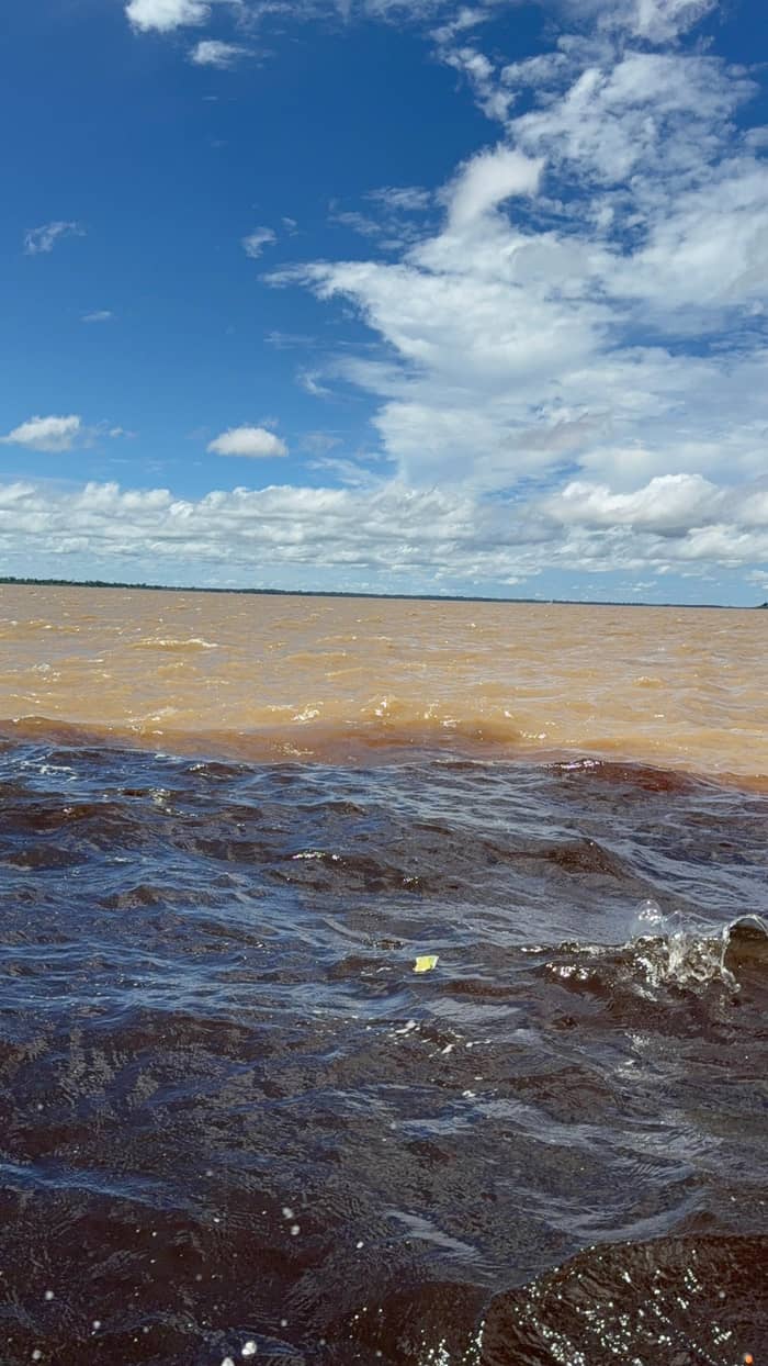
The geography explains the position. According to NASA, the Amazon proper begins at Manaus, where the Solimões, which is the upper Amazon, meets the Negro in central Amazonas.4 In other words, the city sits where the river gets its famous name. The two rivers share a channel for several kilometers east of the city without blending, a sight that day tours from Manaus are built around.18 For a traveler it is a handy fact to carry on the boat, since the guide's explanation of the colors starts from exactly this point.
A city of that size is not a jungle camp, and it is better not to expect one. Manaus has an airport, an opera house and a market, and the untouched forest begins outside it. What the city gives you is access: a river port, hotel pickups and boats that reach forest, lake and archipelago within a day, with comfortable beds, hot showers and air-conditioned rooms to come back to afterwards.
Pick your forest
Match what you want to see to the gateway or tour that delivers it.
If I have a single day around Manaus
The full-day river tour
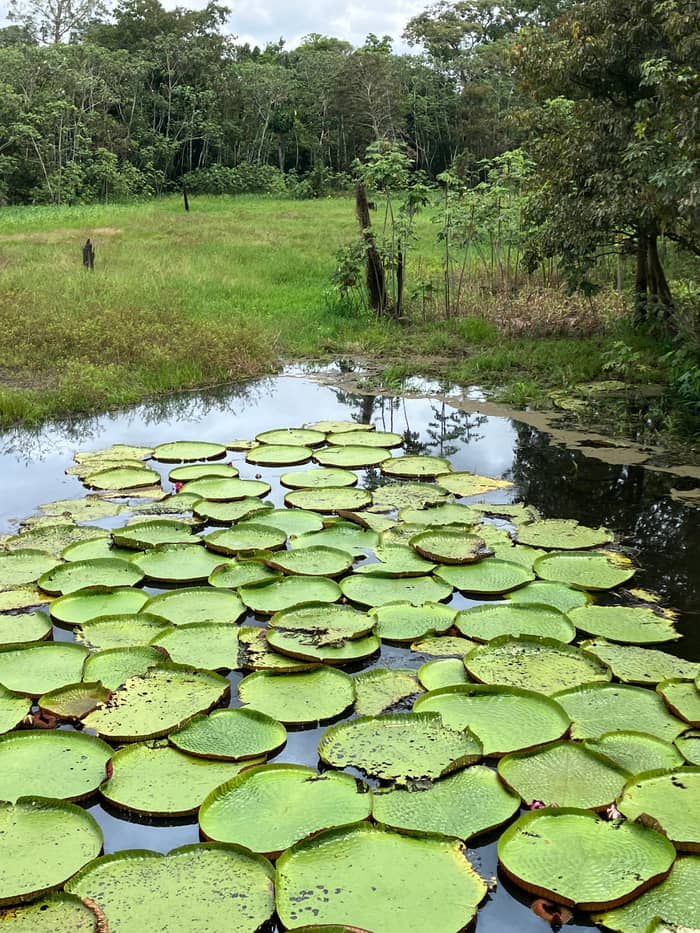
It includes the Meeting of the Waters and canoes.
If I want an archipelago trek
The Anavilhanas trek
A trek of 8 hours in the archipelago.
If I want waterfalls and caves
Presidente Figueiredo
A day trip of 12 hours from Manaus.
If I want to start in Peru
Iquitos
Peru's tourism board names it the departure point.5
If I want to cross to the Atlantic by boat
The local boat to Belém
A trip of 5 days, hammock accommodation.
If I want the least walking
The river tour
Boat and canoe stops with a regional lunch.
Forest from Manaus
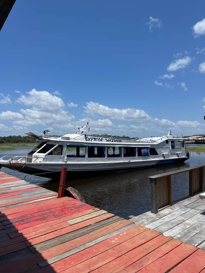
Easiest
Boat, canoes, village
On foot
Anavilhanas trek
Longest day
Presidente Figueiredo
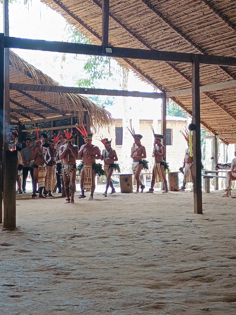
Visitors choose Manaus because the forest is reachable in hours rather than days. Take the site's own day tour as an example: hotel or airport pickup, a boat out to Lake Janauari and the point where the rivers touch, canoes in the lily channels, a village call and a fish lunch. Pickup arrangements differ by listing, so check the meeting point and the start time when you book rather than on the morning of the trip.
The options widen from there. The city government says the Tupé sustainable development reserve is just 25 minutes by river from Manaus.19 A trek in the Anavilhanas archipelago takes 8 hours with pickup included, and the Presidente Figueiredo waterfall day takes 12 hours. The same city can also supply a full day of river, a night of piranha fishing or a multi-day lodge stay, so each of these is a different kind of forest day, from water and canoes to trails and falls.
That range is why Manaus works as a gateway in a way that a smaller river town does not. You can land in the morning, see the Meeting of the Waters the same afternoon, sleep in a hotel, and still choose next day between a lodge, a waterfall and an archipelago. Planning a longer stay rewards the effort, but a single day already gives a clear first impression of where the rainforest is and how the rivers shape it.
Price the rainforest
Compare the river day, the archipelago trek and the waterfall day by from-price.
Look at 3 options
Compare the river day, the archipelago trek and the waterfall day by from-price.
≈
View≈
View≈
ViewStarting prices as on the booking platform, converted at the ECB reference rate. You see the exact price at booking.
Follow the river
The source
Tiny mountain streams combine into the river.9
Upstream hub
Peru's departure point for river journeys.5
The border
A Solimões gauge town in Brazil.10
The meeting
The Solimões and the Negro form the Amazon.4
Downstream
A ferry of 36 hours runs from Manaus.
The sea
The river reaches the Atlantic in Brazil.11
A wild place near the city is the Anavilhanas archipelago in the Rio Negro, which is worth a day even if you have seen other forest. INPA ranks it among the world's biggest river archipelagos, with more than 400 islands that come and go with the river, and says the water level moves by as much as 10 meters between ebb and flood.20,49 Because black water bathes the islands, they carry igapó forest, with soggy and very acid soil.50
NASA notes that the Rio Negro has two long archipelagoes upstream of Manaus, which is why boat tours north and west of the city show such different scenery from the muddy Solimões.21 Within the city limits, MUSA takes up 100 hectares of the Adolpho Ducke forest reserve and has a 42-meter observation tower above the canopy.40,39 The museum is the easy option for travelers with only a few hours, since it combines forest trails and a pond of giant water lilies inside the city limits.51
ACTO's figures hint at the climate: yearly rainfall of 200 mm in the Andes rises past 6,000 mm in places on the plains, and about 3,000 species of fish live in the basin.47,52 You do not need to memorize those numbers to travel well. They explain why packing a raincoat is sensible, and why the water level, and so the choice of tour, changes through the year. In practice the forest's wetness is a daily fact, so a light rain jacket matters more than almost anything else in the bag.
Video
Nations Uncovered on YouTube · Until you tap play, no video is loaded.
The region has the largest continuous tropical forest in the world
Before you pick a gateway
Iquitos, in Peruvian Loreto, is the departure point Peru's tourism board names for journeys along the river into the rainforest, and the board calls the river the main communication route for millions of people.5,53 The river is how goods and people move in this part of the world, so a trip by boat is as much a glimpse of daily life as a tour of scenery. Tabatinga is a river town on the upper Solimões where the Geological Survey of Brazil reads the river level.10
Downstream of Manaus, Santarém is linked to the city by a ferry of 36 hours, and a local boat trip of 5 days runs from Manaus to Belém. Both listings say plainly that they are transportation ferries and not the best option for jungle sightseeing, which is a fair summary of river transport in the Amazon: it is the road, not the show. Treat those trips as overland travel on water rather than as sightseeing, and budget days, not hours, for them.
Porto Velho, on the Madeira, is a gauge town in Rondônia, and the Geological Survey also reads the Purus at Beruri and the Rio Branco at Boa Vista, which shows how widely the basin spreads.15,27,28 A city such as Manaus is simply the place where these rivers become visible to a traveler in a single afternoon. For visitors, the plain rule is to pick a gateway close to the kind of forest you want, then plan part of the trip around the river rather than the road.
The rainforest is not static. According to NASA, the rivers around Manaus are at their widest from May to July, the high-water months, with the rise running to several meters, and they sit near low water in September.46 Operators feel the swing too: dry-season trips can lose a few activities and stops, as one listing warns, so the calendar shapes what a day on the water looks like.
The swing can be extreme. At Manaus port the gauge has read as low as 13.63 meters in 2010 and as high as 29.77 meters at the record flood, with 15.14 meters in October 2023.54,24,55 Neither extreme is typical, and both are reminders that planners of lodges and boat routes treat the water level as the main variable of the year. A visitor who sees the forest in the flood sees treetops from a canoe, and a visitor in the dry season walks on sand where the canoe went.
For a first trip, either season works, because the structure of the day stays the same: a boat, a lake, a village and a meal. If you have a choice, ask your operator how the current water level changes the stops, and plan the trek-heavy trips for lower water and the canoe-heavy ones for high water. That one question does more for your day than any season chart. Treat the answer as the real itinerary: it decides which channels the canoe enters, which trails are dry and how long the walk from the landing is.
FAQ
The Government of Brazil gives the Amazon biome an area of about 4.2 million km2 in nine countries.1
The city government says Manaus lies in the world's largest tropical forest.16
Their confluence at Manaus forms the Amazon, says NASA.4
Listings include a full-day river tour from Manaus with hotel or airport pickup.
Peru's tourism board names Iquitos the departure point for journeys into the rainforest.5
The rise runs to several meters, peaking from May to July.46
Sources
Heading for the Amazon? Ask a real person here.